Project Overview
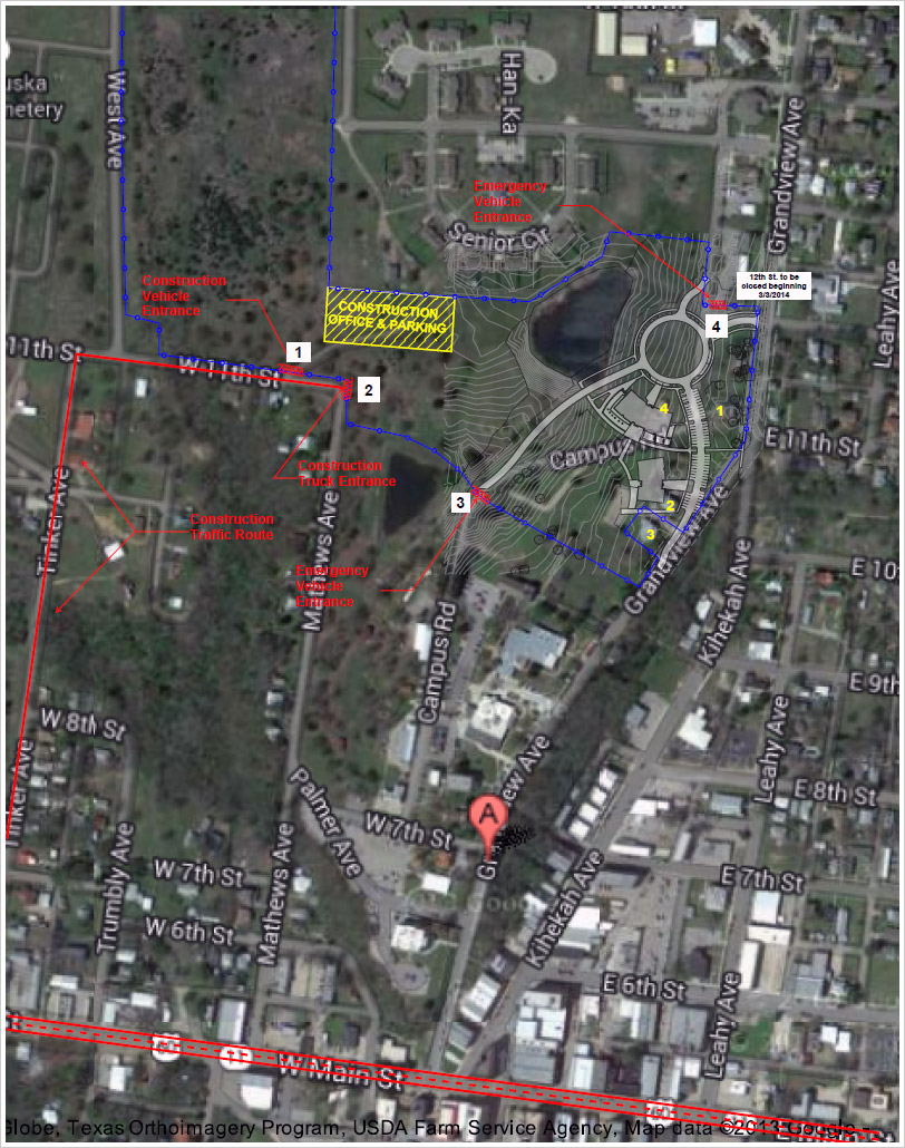
The map below displays the first construction logistics map, which shows the impacted areas. Construction began on Monday, January 13, 2014. The areas inside the blue line (construction fence) are be accessible. Campus Road is available for emergency vehicles only.

The map will continue to change with the progression of the project and the TDLA office will continue to provide updates to the map.

If you have any issues concerning the accessibility of the campus please call or email your concerns to the following:
- Silas Satepauhoodle, ssatepauhoodle@osagenation-nsn.gov, 918-287-5644
PDF copy: Master Plan Logistics Map - Updated March 18, 2014
Artwork


